For Project Peru’s work in Peru go to Zapallal – the work of the refuge
Peru: Geographical
Geographical Position
Situated on the west/Pacific coast of South America, between latitude 0º01’48” and 18º2’05” South and 81º19’35” and 68º30’11” West. The whole territory lies in the tropical zone south of the equator, which passes through Ecuador, and north of the Tropic of Capricorn, which passes through Chile.
Land area
1,285,216 km² (6th largest in all America, 3rd largest in Latin America, 19th in the world, 9 x size of UK, smaller than Alaska).
Frontiers
To the north with Ecuador (1,529 km: 3 sections in dispute) and with Colombia (1,506 km); to the south with Chile (169 km); to the east with Brazil (2,822 km) and with Bolivia (1,047 km); to the west the Pacific coast (3,080 km).
Terrain
The Andean Cordillera runs from north to south, forming three principal natural regions: La Costa – the coastal region (a narrow coastal desert ribbon where 58% of the population live); La Sierra – huge Andean mountains and narrow valleys (28.1%); La Selva – the jungle area forming part of the great territory of the Amazon region (13.9%).
Eco diversity
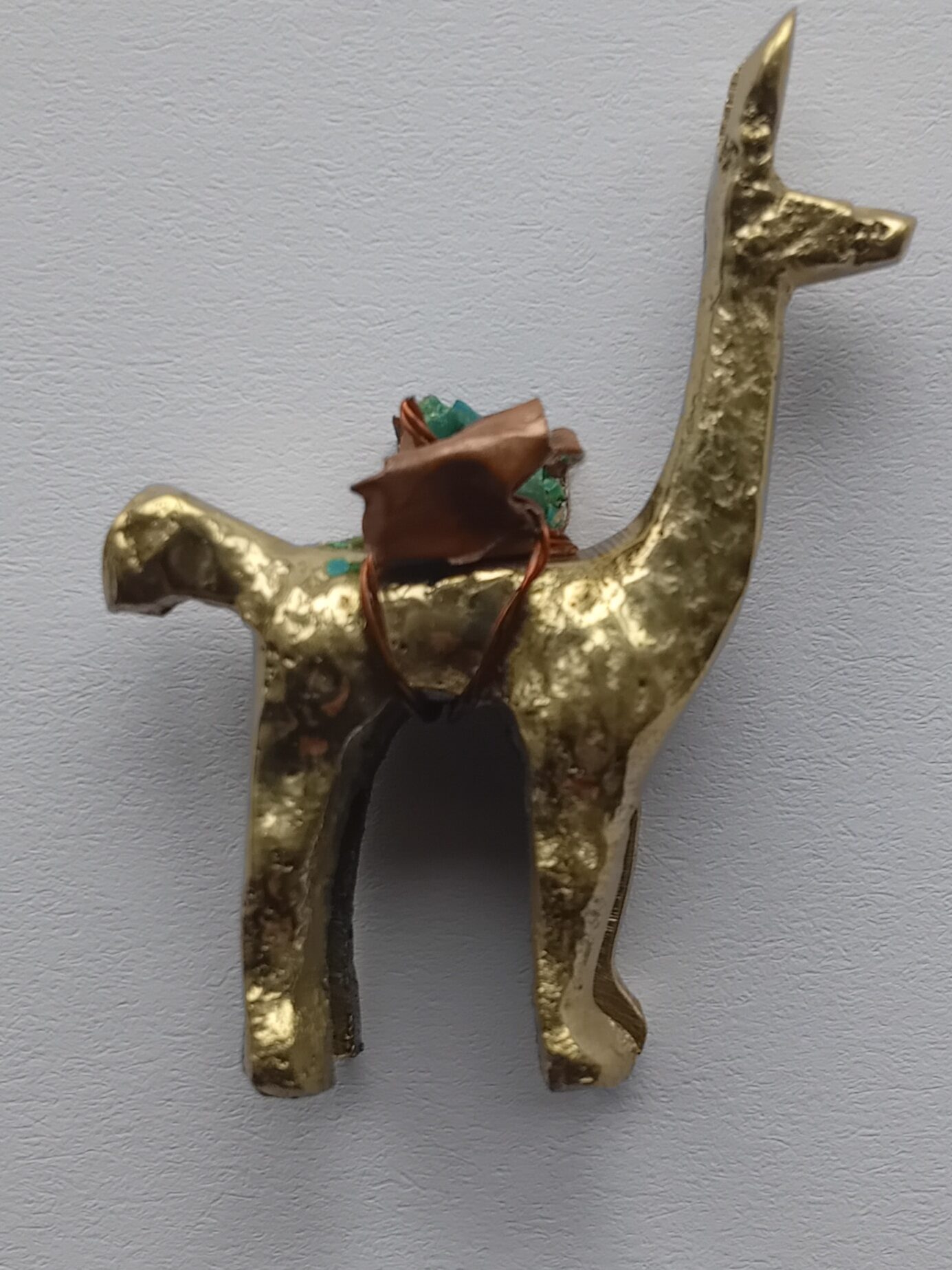
In Peru there exist 84 of the 115 world’s ecological zones and it ranks among the first in the world in biodiversity. It is the 1st in birds, with 1,701 species; 2nd in primates with 34 species; 3rd in mammals with 361; 5th in reptiles with 297 and 5th in amphibians with 251. For example, the Manu National Park and the Tambopata-Candamo National Reserve on the southern Amazon, are a paradise of megadiversity. In just one tree Shihuahuaco (dipteryx micrantha) of Madre de Dios, entomologists found 5,000 specimens of insects, 80% of them new to science. A first Peruvian genetic catalogue of 3,000 plants has classified 90 of ornamental value, 100 useful for making tools, 110 for dyes and tints, 35 for drinks, 36 for essential oils and waxes, 334 toxics for use as organic insecticides, 401 timber yielding, 524 edibles and 213 for medicinal use.
Elevation extremes
0m at Pacific Ocean to 6,768 m at the peak of Huascarán. Lima is 153m above sea level.
Climate
Varies from tropical in the east to dry desert in the west and it depends, too, on altitude.
- Coast (la costa) – equable temperatures, normal annual average about 20ºC (about 68ºF), moderated by winds blowing from the cool offshore Peru or Humboldt Current. There is less than 51mm (2″) of rain each year. Mist-laden clouds known as la garúa cover much of western slopes of the sierra (and Lima) from June to October.
- Mountains (la sierra) – temperature ranges seasonally from about -7 to 21ºC. Rainfall is usually scanty especially on western slopes, but in some localities heavy rains fall, mostly from October to April.
- Jungle (la selva) – extremely hot and humid. Annual rainfall in some districts averages as much as 3,810mm (150″), principally falling from November to April.
Peru: Social
Population
About 31.23 million (Peru 2017 Census). The next census is due to be held in 2027.
Approximately 25% of the population of Peru are aged 15 or under.
Gender Balance
50.80% women; 49.20% men (Peru 2017 Census)
Life expectancy
73.4 years – men, 78.3 years – women, (2018-WHO estimate).
Race and Ethnicity
Peru is a multi-ethnic country, which means that it is home to people of many different historical backgrounds. Therefore, it is a multi-cultural country as well. In the 2017 Census, those of 12 years old and above were asked what “ancestral origin” they belong to, with 60.2% of Peruvians self-identifying as Mestizos, 22.3% as Quechuas, 5.9% as White, 3.6% as Afro-Peruvian, 2.4% as Aymaras, 0.3% as Amazonians, 0.15% as Others.
Urban / rural / regional divide in Peru
72.3% of the population live in urban areas; 27.7% live in rural areas; about 10 million (2017 estimate – 29.2%) live in Lima & Callao; 22.2% live in other main cities; 20.9% in smaller towns. As an indication of the population shifts over the past 80 years or so, approximately 58% of the population now live in the coastal areas (in 1940 it was 28.3%); 28.1% now live in the sierra (in 1940 it was 65%); 13.9% now live in the selva, though the increase there is mostly urban, whereas it was 6% in 1940.
Peru: Political
National, regional and local government
.svg)
Capital city – Lima.
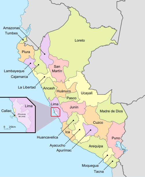
Peru is divided into 24 regions (known as departments until 2002, though this word is still used frequently as most borders remain the same), and one constitutional province (El Callao). Each region is divided into provinces: there is a total of 180 provinces (including El Callao); these in turn are divided into districts (totalling 1,747). One of these districts is Puente Piedra (in the Cono Norte), where our refuge is situated.
Head of State
President Pedro Castillo, took office on 28th July 2021 but following his impeachment on 7th December 2022 his vice-president Dina Boluarte became president. The 2026 presidential elections first round were held in April 2026 with a second round due in June 2026. After Dina Boluarte was impeached and removed from office, José Jerí, as president of the Congress, was sworn into office as president on 10th October 2025. However, he was subsequently replaced in February 2026 by José María Balcázar, with his term due to end on 28th July 2026.
Peru’s presidents are constitutionally elected for a single five-year term, though after a break of five years they are permitted to seek re-election for a second term of office.
Symbols of Peru
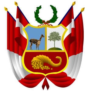
For information on the national flag, national coat of arms, national anthem and more, see our page Symbols of Peru
National Holiday: Fiestas Patrias
28th July, celebrating independence from Spain in 1821. So, in 2021, Peru celebrated 200 years of independence.
Two Peruvian Saints and a Pope
There are two native-born Peruvian saints, Santa Rosa de Lima, celebrated in Perú on 30th August and San Martín de Porres, celebrated on November 3rd. Pope Leo XIV was elected Pope on May 8th 2025. Although American by birth he has had dual Peruvian nationality since 2015.
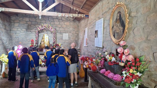
Santa Rosa de Lima is the Patron Saint of Peru and is known both for her life of severe penance and her care for the poverty stricken of the city through her own private efforts in the early 17th century, and her image is widely featured in the Catholic world. She is additionally known as the patron saint of embroidery, gardening and the cultivation of blooming flowers. Her childhood home is celebrated in a chapel in the Canta valley, quite near the refuge.
San Martín de Porres is best known for his charitable work. His piety allowed him access to the Dominican order in the early 17th century, and his acts of compassion for the sick became part of the justification for his canonization as the first black Saint of the Americas. He is the patron saint of mixed-race people, public health workers and all those seeking racial harmony.

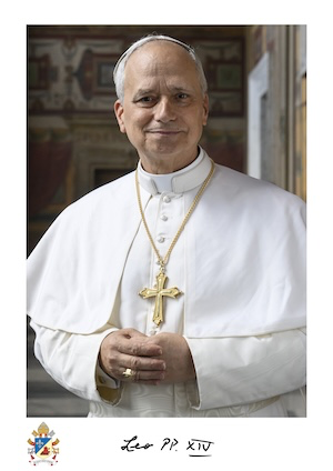
Pope Leo XIV’s election to the papacy in 2025 reflected among other things his many years spent as a missionary, teacher, priest, administrator and later Bishop of the Diocese of Chiclayo and a Cardinal, in Peru.
Languages
The principal languages in Peru are Spanish, Quechua and Aymara. In urban areas of the country, especially in the coastal region, most people only speak Spanish, while in many rural areas of the country people may be bilingual, and especially in the Amazon regions over 50 separate indigenous languages are prevalent. The most common language is Spanish, spoken by about 82.6% of the entire population followed by the country’s indigenous languages, especially all types of Quechua (13.9% combined) and Aymara (1.7%), both of which also have co-official status according to Article 48 of the Constitution of Peru.
Currency
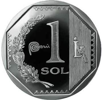
The Sol (plural: Soles): currency symbol S/ ; the Sol is sub-divided into 100 céntimos.
The Peruvian Sol is the historic currency of Peru. Between 1985 and1991 it was renamed Inti. After 1991 Peru reverted to the Sol and the “new” Nuevo Sol was introduced, but since 2016 this has reverted officially to being called simply the Sol, though both terms can still be used.
Peru: International
International currency exchange: for an up-to-date indication of the value of Peruvian currency against other international currencies you could look at this currency converter.
International currency code: PEN
International time zone for Peru: GMT-5
International dialling code: 00 51
International internet country code: .pe
International Airport
In September 1910 Jorge Chávez, a Peruvian aviator, flew the first monoplane (a Blériot XI) across the Alps and achieved what had been thought impossible, to cross from Switzerland to Italy. He completed the crossing but crash-landed and died of his injuries five days later, aged only 23.
International sea-port
Callao: from the time of the arrival of Pizarro with his Spanish conquistadores in 1532, Callao has been Peru’s premier port and has, in recent years, been used by Project Peru for its incoming containers with donated goods.

